Potentially catastrophic rains are headed toward Los Angeles, a region already affected by recent extreme weather and climate events, making it more vulnerable to the influx of water.
According to the National Weather Service, millions of people in California are on flood alert during the Christmas holidays.
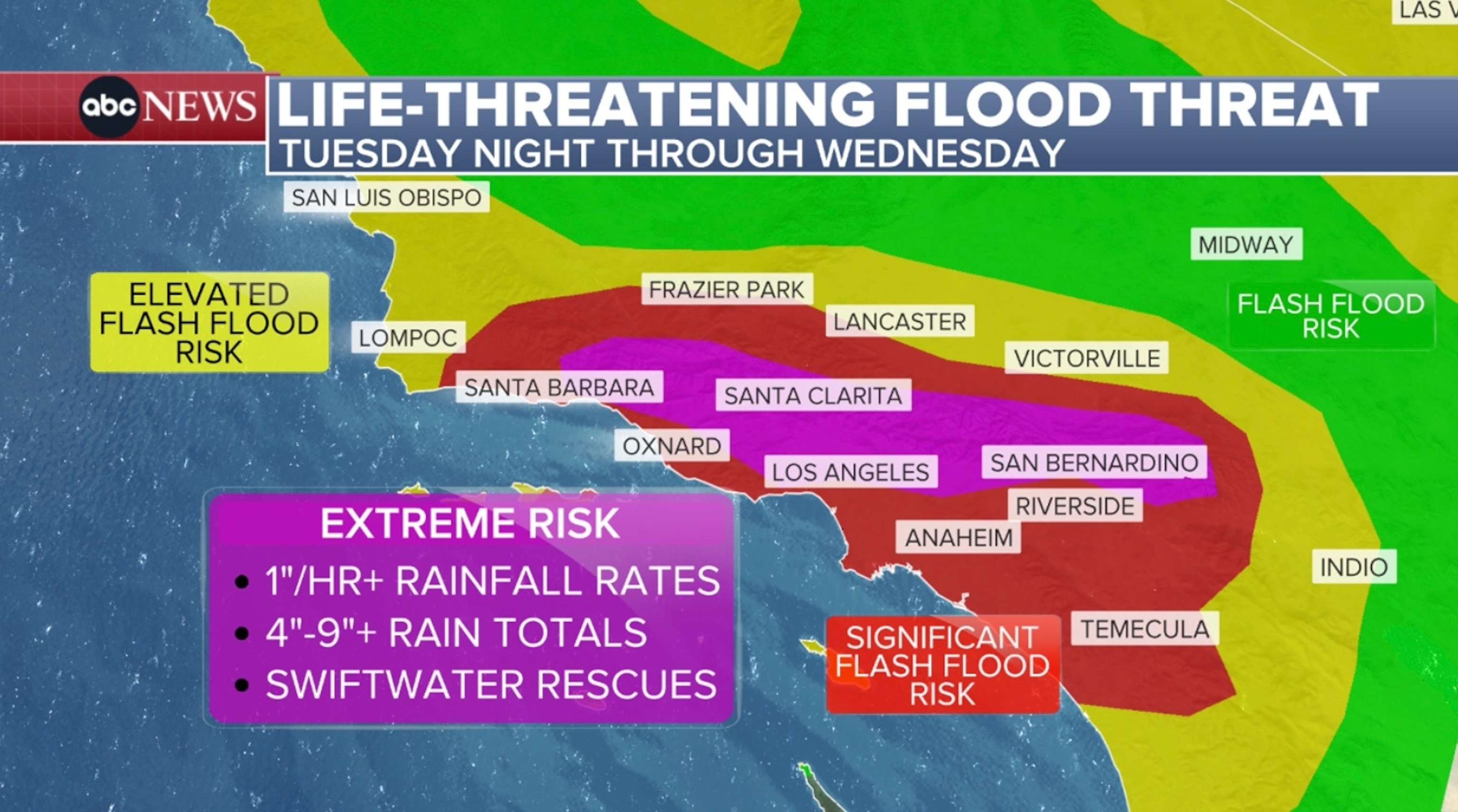
But Southern California will be in the spotlight for a strong and prolonged atmospheric river that will bring periods of heavy rain beginning Tuesday night and lasting through Thursday night.
Significant and widespread flooding caused by excessive rainfall is likely, with possible debris flow impacts in recent burn areas.
The first round of rain, starting around 9 pm Tuesday, will be the heaviest. Heavy rain is expected first over the Santa Barbara area before moving into the Los Angeles area around midnight.
Rain over Los Angeles could continue until 6 pm Wednesday, which equates to 18 hours of moderate to heavy rain over the region on Christmas Eve.

Rainfall rates can exceed 1 inch per hour at times, especially at higher elevations.
Widespread rainfall totals over the 18-hour period are expected to reach between 3 inches and 7 inches, but some localized spots could see 9 inches or more.
The month of December typically brings 2 to 3 inches of rain to the region, on average, records show.
The National Weather Service’s Weather Prediction Center issued a rare “High Risk” (level 4 of 4) for excessive rainfall and flash flooding Wednesday in parts of Southern California. This includes parts of Santa Barbara, Ventura, Los Angeles and San Bernardino counties.
“High risk” includes Los Angeles, Burbank, Altadena, Glendale, San Bernardino, Santa Clarita and Thousand Oaks.
Being at “high risk” is rare. This risk only occurs about 4% of days, accounting for one-third of all flood-related deaths and 80% of all flood-related damage, according to the National Weather Service.
The Weather Prediction Center has issued a level 4 of 4 risk, a significant risk, for excessive rainfall and flooding for Ojai, Thousand Oaks, Simi Valley, Santa Clarita, San Fernando, Glendale, West Hollywood, El Monte, San Bernardino and the Angeles National Forest.
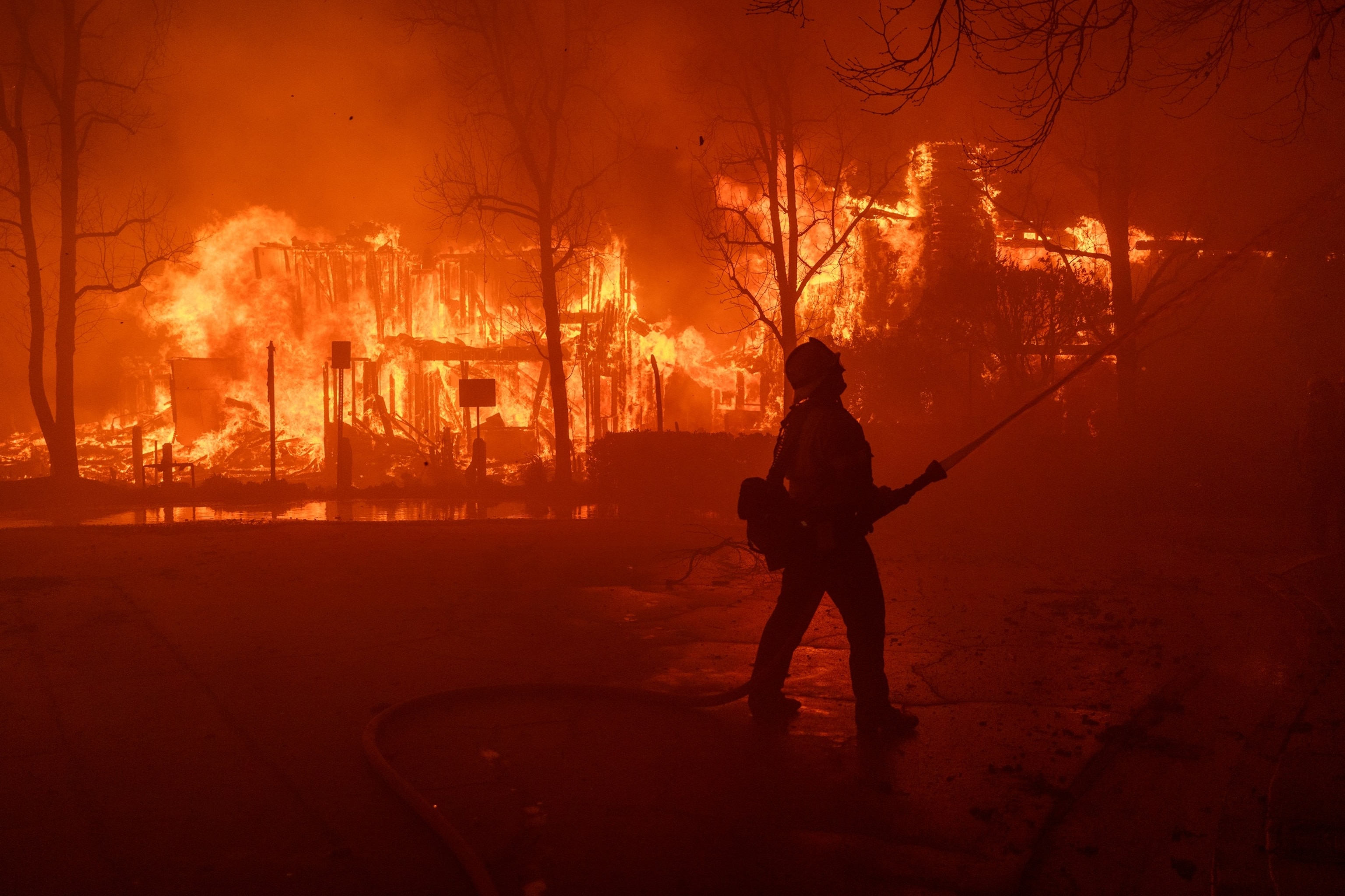
Los Angeles and Ventura counties were devastated by the Palisades and Eaton fires in January.
Evacuation warnings are in effect Tuesday through Thursday at 11 p.m. for the burn scar areas of Palisades, Sunset and Hurst.

In this Jan. 7, 2025, file photo, firefighters battle the Eaton Fire with high winds as many homes burn in Pasadena, California.
David McNew/Getty Images, FILE
Evacuation orders are in effect for a select number of vulnerable properties. Los Angeles police were going door-to-door, alerting residents at vulnerable addresses, ABC Los Angeles station KABC reported.
Areas scarred by recent wildfires are especially prone to dangerous flash flooding and could also trigger debris flows and landslides. The threshold for causing flash flooding decreases with scorched soil. Lower rainfall totals could still cause flash flooding and may develop very quickly.
“With as much rainfall totals as we expect, significant and widespread flooding is likely in urban and poorly drained areas, especially in and around higher terrain,” National Weather Service Oxnard meteorologist in charge Ariel Cohen said during a news conference Tuesday afternoon. “There will almost certainly be numerous rockslides and mudslides, along with areas of severe flooding in urban areas and along highways, so being on the roads will be exceptionally dangerous.”
Precipitation that would normally be absorbed by the ground instead remains as runoff and can quickly lead to dangerous and significant flash flooding, especially downstream and downhill from an area of wildfire burn scars.
The National Weather Service notes that, in some cases, burned soil can repel water as much as pavement. A general rule of thumb is that half an inch of rain in less than an hour is enough to cause flash flooding in a burned area. Susceptibility to flash flooding within the burned area is greatest during the first two years after the fire.
In recent years, parts of California have experienced a shift from major drought stages to a prolonged period of above-average precipitation, allowing for abundant vegetation growth.

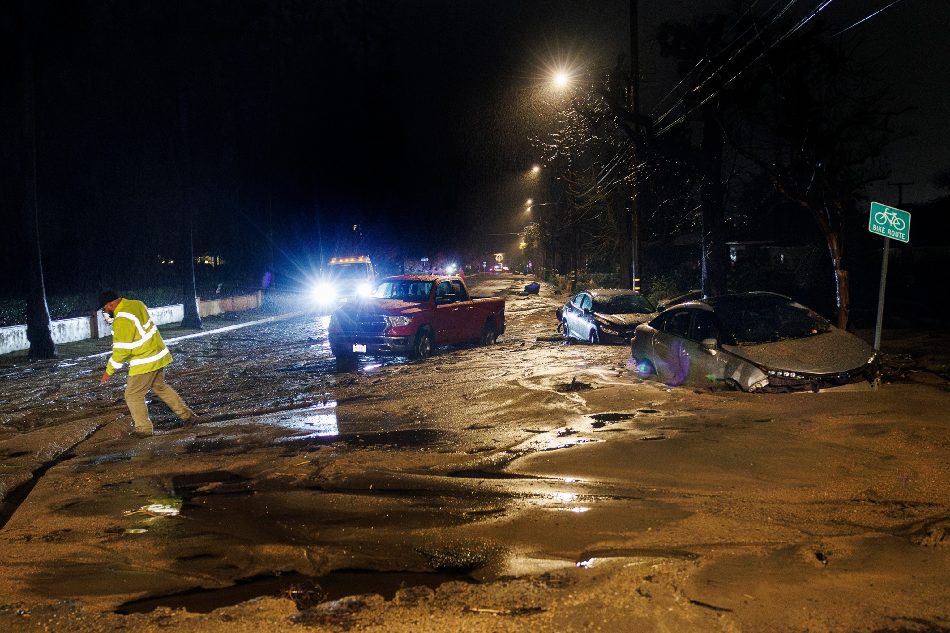
In this Feb. 13, 2025 file photo, heavy rain created a mud-filled debris flow that sent cars down Tanoble Drive toward Mendocino Street in the area burned by the Eaton Fire in Altadena, California.
Gina Ferazzi/Los Angeles Times via Getty Images, FILE
Experts say hydroclimatic whiplash — the rapid change between wet and dry conditions — likely contributed to the severity of the wildfires burning in Southern California.
Flood impacts include significant and widespread flooding of urban roads, a high risk of large landslides and rockslides, and rapid rises of streams, streams and rivers, which will likely lead to swift water rescues.
Residents should expect significant travel delays, cancellations and road closures.
Much of California is also facing strong winds starting Tuesday night. The winds will be stronger in the highest and most mountainous areas.
While the dangerous threat of flash flooding is focused on Southern California, the northern half of the state will face the brunt of the strong winds in the coming days.
High wind warnings have been issued for cities including Sacramento, Redding, Santa Barbara and Santa Clarita. Wind gusts of 60 to 70 mph are possible in these areas, creating the threat of power outages and wind damage. Isolated gusts over 70 mph are possible in some of the mountains.
Wind advisories are in effect for many major cities along the coast, including Los Angeles, San Francisco and San Diego, with wind gusts of 40 to 50+ mph possible.
ABC News’ Dan Peck contributed to this report.


